Western Siberia. Height parameters of the West Siberian Plain Siberian Lowland
West Siberian Plain The West Siberian Lowland is one of the largest low-lying accumulative plains in the world. It is located north of the low-hill plain of Kazakhstan and the Altai mountains, between the Urals in the west and the Central Siberian plateau in the east. Extending from north to south up to 2500 km, from W. to E. from 1000 to 1900 km; an area of about 2.6 million sq. km 2. The surface is flat, slightly dissected, with small height amplitudes. The heights of the lowlands of the northern and central regions do not exceed 50-150 m, low elevations (up to 220-300 m) are characteristic mainly of the western, southern, and eastern margins of the plain. A strip of hills also forms the so-called. Siberian Ridges, stretching in the middle part of the Z.-S. R. from the Ob almost to the Yenisei. Wide, flat spaces of interfluves predominate everywhere, with slight slopes of the surface, heavily waterlogged and in places complicated by moraine hills and ridges (in the north) or low sandy ridges (mainly in the south). Significant areas are occupied by flat ancient lake basins - woodlands. The river valleys form a relatively sparse network and in the upper reaches they are most often shallow hollows with poorly pronounced slopes. Only a few of the largest rivers flow in well-developed, deep (up to 50-80 m) valleys, with a steep right bank and a system of terraces on the left bank. Z.-S. R. formed within the epihercynian West Siberian plate, the basement of which is composed of intensely dislocated Paleozoic deposits. They are everywhere covered with a cover of loose marine and continental Meso-Cenozoic rocks (clays, sandstones, marls, etc.) with a total thickness of over 1000 m(in foundation depressions up to 3000-4000 m). The youngest Anthropogenic deposits in the south are alluvial and lacustrine, often covered by loess and loess-like loams; in the north - glacial, marine, and glacial-marine (capacity in places up to 200 m).
In the cover of loose deposits Z.-S. R. groundwater horizons are enclosed - fresh and mineralized (including brines), hot (up to 100-150 ° C) waters are also found (see West Siberian artesian basin). In the depths of Z.-S. R. the richest industrial deposits of oil and natural gas are enclosed (see the West Siberian oil and gas basin).
The climate is continental, quite severe. In winter, masses of cold continental air of temperate latitudes predominate over the plain, and in the warm season, an area of low pressure is formed and humid air masses from the North Atlantic often come here. The average annual temperatures are from -10.5°C in the north to 1-2°C in the south, the average temperatures in January are from -28 to -16°C, and in July from 4 to 22°C. The vegetation period in the extreme south reaches 175-180 days. The bulk of precipitation is brought by air masses from the west, mainly in July and August. Annual precipitation from 200-250 mm in tundra and steppe zones up to 500-600 mm in the forest zone. Snow cover thickness from 20-30 cm in the steppe up to 70-100 cm in the taiga of the Yenisei regions. The territory of the plain drains more than 2,000 rivers, the total length of which exceeds 250,000 km. km. The largest of them are the Ob, Yenisei, Irtysh. The main sources of river nutrition are melted snow water and summer-autumn rains; up to 70-80% of the annual runoff occurs in spring and summer. There are many lakes, the largest are Chany, Ubinskoye, and others. Some of the lakes in the southern regions are filled with salty and bitter-salty water. Large rivers are important navigable and rafting routes connecting the southern regions with the northern ones; The Yenisei, the Ob, the Irtysh, and the Tom have, in addition, large reserves of hydropower resources. The flatness of the relief Z. - S. r. determines a distinct latitudinal geographic zonality. A specific feature of most zones of Western Siberia is excessive soil moisture and, as a consequence, the wide distribution of marsh landscapes, which give way to solonetzes and solonchaks in the south. The north of the plain is a tundra zone, in which arctic, moss, and lichen landscapes form on arctic tundra and tundra gley soils, and in the south, shrub tundra. To the south there is a narrow strip of forest-tundra, where on peaty-gley, gley-podzolic and marsh soils complex landscape complexes of shrub tundra, spruce-larch woodlands, sphagnum and lowland bogs are developed. Most of the Z.-S. R. refers to the forest (forest-marsh) zone, within which coniferous taiga prevails on podzolic soils, consisting of spruce, fir, cedar, pine, Siberian larch; only in the extreme south of the zone are taiga massifs replaced by a strip of small-leaved birch and aspen forests. The total forest area exceeds 60 million hectares. ha, wood reserves 9 billion. m 3, and its annual growth is 100 million. m 3. The forest zone is distinguished by the wide development of raised ridge-hollow sphagnum bogs, which in some places account for more than 50% of the area. Of the animals of the forest zone, the following are typical: brown bear, lynx, wolverine, marten, otter, Siberian weasel, sable, elk, Siberian roe deer, squirrel, chipmunk, muskrat, and other representatives of the fauna of the European-Siberian subregion of the Palearctic. To the south of the subzone of small-leaved forests, there is a forest-steppe zone, where leached and ordinary chernozems, meadow-chernozem, dark gray forest and marsh soils, solonetzes, solods . The extreme southern part of the Z. - S. p. It occupies the steppe zone, in the north of which until recently forb feather grass steppes predominated, and in the south - feather grass-fescue steppes. Now these steppes, with their fertile chernozem and dark chestnut soils, have been plowed up, and only areas with saline soils in places have retained their virgin character. Lit.: West Siberian lowland. Essay on nature, M., 1963; Western Siberia, M., 1963. N. I. Mikhashov.
Great Soviet Encyclopedia. - M.: Soviet Encyclopedia. 1969-1978 .
See what the "West Siberian Plain" is in other dictionaries:
West Siberian Plain ... Wikipedia
Between the Urals in the west and the Central Siberian Plateau in the east. OK. 3 million km². The length from north to south is up to 2500 km, from west to east up to 1900 km. Height from 50 150 m in the northern and central parts to 300 m in the western, southern and ... ... Big Encyclopedic Dictionary
WESTERN SIBERIAN PLAIN, between the Urals in the west and the Central Siberian Plateau in the east. OK. 3 million km2. The length from north to south is up to 2500 km, from west to east up to 1900 km. Height from 50 150 m in the northern and central parts to 300 m in ... ... Russian history
One of the largest on earth. Takes b. h. Zap. Siberia, stretching from the coast of the Kara Sea in the north to the Kazakh uplands in the south, from the Urals in the west to the Central Siberian Plateau in the east. OK. 3 million km². Wide flat or ... Geographic Encyclopedia
Between the Urals in the west and the Central Siberian Plateau in the east About 3 million km2. The length from north to south is up to 2500 km, from west to east up to 1900 km. Height from 50 150 m in the northern and central parts to 300 m in the western, southern and eastern. ... ... encyclopedic Dictionary
West Siberian Plain- West Siberian Plain, West Siberian Lowland. One of the largest low-lying accumulative plains of the globe. It occupies most of Western Siberia, stretching from the coast of the Kara Sea in the north to the Kazakh uplands and ... Dictionary "Geography of Russia"
West Siberian Plain- West Siberian Plain ... Russian spelling dictionary
West Siberian Plain of the USSR. physical map - … Geographic atlas
The West Siberian lowland, or plain, is the third largest plain in the world. Its area is about 2.6 million km2. From the harsh coast of the Kara Sea, it stretches to the foothills of the mountains of Southern Siberia and the semi-deserts of Kazakhstan for 2500 km, and from the Urals to the Yenisei - up to 1900 km.
The boundaries of the plain are clearly defined natural boundaries: in the north - the coastline of the Kara Sea, in the south - the foothills of the Kazakh hills, Altai, Salair and Kuznetsk Alatau, in the west - the eastern foothills of the Urals, in the east - the Yenisei valley.
Features of nature. Nowhere else in the world can one find such a huge space with such a flat relief - neither a hillock, nor a ridge. Such a relief was formed by loose deposits of rivers and ancient glacial sediments, which covered the Paleozoic plate with a thick sedimentary cover (3--4 thousand m). The horizontal layering of sedimentary layers is the main reason for the flat relief of the plain. It affected the relief and glaciation, but the glacier here did not cross 60 ° N. sh. In the south of the plain, during the floods of rivers, dammed in the north by ice, lake and river sediments - sands and loams - were deposited in colossal spaces. Glaciation affected not only the relief, but also the flora and fauna. When the glacier receded, the north of the plain was conquered by tundra and taiga, although before there were broad-leaved forests inhabited by mammoths, woolly rhinos, and giant deer. According to the remains of trunks in the swamps, it can be judged that the forest boundary was located several hundred kilometers to the north than at present.
The continentality of the climate in the expanses of the West Siberian Plain increases when moving from north to south. This is expressed in an increase in annual temperature amplitudes, a decrease in the amount of precipitation, and a reduction in the duration of spring and autumn - the transitional seasons of the year.
When temperate air masses collide with tropical air masses, cyclones arise, bringing rain. At the beginning of summer, the front acts in the south - the steppe zone receives moisture (about 300 mm per year). In July, hot air dominates the entire south of the plain, and cyclones move north, bringing precipitation to the taiga zone (up to 500 mm per year). In August, the front reaches the tundra, where up to 250 mm falls annually. In winter, cyclones of the Arctic front act on the border of moderate and arctic air masses. This softens the frosts in the north, but due to high humidity and strong winds, the harshness of the climate here also manifests itself at lower temperatures.
surface waters. The West Siberian Plain is rich in rivers, lakes, swamps, the distribution of which throughout the territory clearly shows dependence on the relief and on the zonal ratio of heat and moisture. The largest river in the West Siberian Plain is the Ob with its tributary the Irtysh. This is one of the greatest rivers in the world. In Russia, it ranks first in length and basin area. In addition to the Ob and Irtysh, the Nadym, Pur, Taz, and Tobol can be named among the major rivers of the region.
Among the numerous lakes, those that filled the glacial lake basins and were located on the site of former oxbow lakes predominate. In terms of the number of swamps, the West Siberian Plain is also a champion: nowhere in the world is there such a swampy area (800 thousand km 2) as here. A classic example of swampiness is Vasyuganye, a geographical area lying between the Ob and Irtysh rivers. There are several reasons for the formation of such vast swampy areas: the presence of excessive moisture, flat relief, permafrost, low air temperatures, the ability of peat, which prevails here, to retain water in quantities many times greater than the weight of the peat mass.
Natural zones of the West Siberian Plain. The climate of Western Siberia is more continental and harsher than in the east of the European part of Russia, but milder than in the rest of Siberia. The large length of the plain from north to south allows several latitudinal zones to fit here - from the tundra in the north to the steppes in the south.
The enormous size of the West Siberian Plain and the flat relief make it possible to trace the latitudinal-zonal change in natural landscapes with particular clarity. The main distinguishing feature of the tundra is the severity of the climate. Adapting to harsh conditions, tundra plants prepare wintering buds from autumn. Thanks to this, in the spring they are rapidly covered with leaves and flowers, and then bear fruit. In the tundra there are many different plant foods, so many herbivorous birds nest here.
The forest-tundra is the first zone when moving south, where at least 20 days a year there is a summer thermal regime, when the average daily temperatures exceed 15 ° C. Here the tundra alternates with crooked forests and low forests. The subzone of deciduous forests in Western Siberia stretches in a narrow strip from the Ural Mountains to the Yenisei.
The West Siberian forest-steppe stretches in a narrow strip from the Urals to the foothills of the Salair Ridge. The abundance of lake basins is a feature of this zone. The shores of the lakes are low, partly swampy or overgrown with pine forests. In the Kulunda pine forests, along with steppe species - oatmeal, field pipit, jerboa - taiga species live - flying squirrel, capercaillie. In the forest-steppe and steppe zones on fertile soils, good crops of grain and vegetables can be grown. The picturesque landscapes of the south of the plain - birch pegs, elevated areas - manes and lakes - are potential recreational resources of the territory. Manes are sandy ridges from 3 to 10 m high, less often up to 30 m, covered with pine forests. They bring great diversity to the treeless flat landscapes of the south of Western Siberia. In some places, the ridged terrain is full of lakes, which makes the area even more attractive. Kolki are groves of birches and aspens, turning green, like oases, among the lack of water of the surrounding steppe plains.
Natural resources are very diverse. The oil and gas reserves of such fields as Urengoy, Yamburg, Medvezhye, Surgut, Nizhnevartovsk make Western Siberia one of the world leaders. 60% of Russia's total peat reserves are also concentrated on its territory. The richest salt deposits are located in the south of the plain. The great wealth of Western Siberia is its water resources. In addition to surface waters (rivers and lakes), huge underground water reservoirs have been found. The economic importance of the biological resources of the tundra and forest-tundra is great - this zone, it would seem, is not rich in life. A significant amount of furs and game is mined in it, there are a lot of fish in its rivers and lakes. In addition, the tundra is the main breeding area for reindeer. The taiga of Western Siberia has long been famous for the extraction of furs and timber.
Deposits of brown coal are associated with ancient sedimentary rocks of the Triassic and Jurassic age, the total thickness of which is more than 800-1000 m. On the territory of the Tyumen region, its reserves are estimated at 8 billion tons. However, the main wealth of Western Siberia is oil and gas deposits. It has been established that this plain is a unique oil and gas province of the Earth. Industrial deposits of oil and gas are spread over almost the entire 2000-meter section of Mesozoic deposits. The average depth of occurrence of oil and gas bearing layers in it varies from 1500 m to 2500-3000 m. Over a decade and a half (from 1953 to 1967) more than 90 deposits of oil, gas and gas condensate (light oil) have been explored.
Searches in the bowels of Western Siberia for "black gold" and "blue fuel" made it possible to discover large reserves of iron ore in the north of the Novosibirsk region. The minerals of the Mesozoic deposits also include hot waters with a temperature of 40 to 120 ° C and containing dissolved salts of chlorides and carbonates, as well as iodine and bromine. They form a huge artesian basin at a depth of 1000 to 3000 m on the territory of the Tyumen, Tomsk, Omsk and Novosibirsk regions. The West Siberian artesian basin covers almost the entire vast territory of the plain. Waters were found here in the Quaternary, Neogene, Paleogene, as well as in the Mesozoic deposits and in the basement of the plain.
What hinders the development of the natural resources of the West Siberian Plain? Its vast diverse riches are not so easy to master. Nature “protected” the oil and gas fields of the region from humans both with thick swamps and frozen soils. Building in such conditions is extremely difficult. In winter, people are hindered by severe frosts, high humidity, and strong winds. In the summer, numerous blood-sucking - midges, midges and mosquitoes overcome.
1. Geographic location.
2. Geological structure and relief.
3. Climate.
4. Internal waters.
5. Soil and vegetation cover and fauna.
6. Natural areas.
Geographical position
The boundary of the West Siberian Plain is clearly expressed in the relief. Its boundaries in the West are the Ural Mountains, in the east the Yenisei Ridge and the Central Siberian Plateau. In the north, the plain is washed by the waters of the Kara Sea, the southern edge of the plain enters the territory of Kazakhstan, and the southeast borders on Altai. The area of the plain is about 3 million km2. the length from north to south is almost 2500 km, from west to east 1500-1900 km. The southern part of the plain is the most mastered by man, its nature has been changed to some extent. The northern and central part of the plain began to be developed in the last 30-50 years in connection with the development of oil and gas.
Geological structure and relief
The geological structure of the plain is determined by its position on the Paleozoic West Siberian plate. The foundation of the slab is a huge depression with steep sides. It consists of the Baikal, Caledonian and Hercynian blocks, broken by deep faults. In the north, the foundation lies to a depth of 8-12 km. (Yamalo-Tazovskaya syneclise), in the middle part the depth is 3-4 km. (Sredneobskaya anteclise), to the south, the depth of occurrence decreases. The cover of the plate is represented by Mesozoic and Cenozoic deposits of continental and marine origin.
The territory of the West Siberian plate has repeatedly been subjected to transgressions. The glaciation of Western Siberia was repeated many times: Demyanskoe, Samarovskoe, Tazovskoe, Zyryanskoe and Sartanskoe. Glaciers moved from 2 centers: from the Polar Urals and the Putorana plateau. In contrast to the Russian Plain, where meltwater flowed to the south, in Western Siberia, which has a general slope to the north, these waters accumulated at the edge of the glacier, forming near-glacial reservoirs. In areas free of ice, there was a deep freezing of the soil.
The modern relief of the plain is due to the geological structure and the influence of exogenous processes. The main orographic elements correspond to the tectonic structures of the plate, although the accumulation of Meso-Cenozoic strata has leveled the unevenness of the basement. The absolute heights of the plain are 100-150 meters, while within the plains alternating highlands and lowlands. The general slope of the plain is towards the north. Almost the entire northern half of the plain is less than 100 meters high. The marginal parts of the plain are raised up to 200-300 meters. These are the North Sosvinskaya, Verkhnetazovskaya, Lower Yenisei uplands, the Ob plateau, the Ishim and Kulunda plains. The Siberian Ridges are distinctly expressed in the middle part of the plain, extending from the Urals to the Yenisei near 63˚N, their average height is 100-150 meters. The lowest areas (50-100 m) are located in the northern parts of Western Siberia. These are Nizhneobskaya, Nadymskaya, Purskaya, Tazovskaya, Kondinskaya, Sredneobskaya lowlands. Western Siberia is characterized by: marine accumulative plains (on the Yamal and Gydan Peninsulas), glacial and water-glacial plains with moraine hills, ridges, etc. (central part of Western Siberia), alluvial lacustrine plains (valleys of large rivers), denudation plains (southern part of Western Siberia).
Climate
The climate of Western Siberia is continental, arctic and subarctic in the north and temperate in the rest of the territory. It is more severe than on the Russian Plain, but softer than in Eastern Siberia. Continentality increases towards the southeast of the plain. The radiation balance is from 15 to 40 kcal/cm2 per year. At the same time, in comparison with the Russian Plain, Western Siberia receives somewhat more solar radiation, due to the lower frequency of cyclones. The western transfer persists, but the influence of the Atlantic is noticeably weakened here. The flatness of the territory promotes deep meridional air exchange. In winter, the climate is formed under the influence of the spur of the Asian High, which stretches along the south of the plain and depression of low pressure over the northern peninsulas. This contributes to the removal of cold continental air from the Asian High to the plain. Winds are dominated by southerly directions. In general, January isotherms are submeridian, from -18˚-20˚С in the west to almost -30˚С in the Yenisei valley. The absolute minimum of Western Siberia is -55˚С. Snowstorms are typical in winter. During the cold period, 20-30% of precipitation falls. Snow cover is established in the north in September, in the south - in November and lasts from 9 months in the north to 5 months in the south. The thickness of the snow cover in the forest zone is 50-60 cm, in the tundra and steppe 40-30 cm. In summer over Western Siberia, the pressure gradually decreases to the southeast. Winds prevail in a northerly direction. At the same time, the role of western transfer is enhanced. July isotherms take latitudinal directions. In the north of Yamal, the average July temperature is +4˚С, near the Arctic Circle +14˚С, in the south of the plain +22˚С. Absolute maximum +45˚С (extreme south). The warm period accounts for 70-80% of precipitation, especially in July-August. Droughts are possible in the south. The largest amount of precipitation per year (550-600 mm) falls in the middle reaches of the Ob from the Urals to the Yenisei. To the north and south, the amount of precipitation decreases to 350 mm. The climate of Western Siberia contributes in many respects to the maintenance of permafrost. The northern and central parts of Siberia (more than 80% of its area) have a moisture coefficient greater than 1 (excessive moisture). Such conditions lead to the development of swamping of the territory. In the south, the coefficient is less than 1 (insufficient moisture).
Inland waters
Western Siberia is characterized by a huge accumulation of inland waters. Several thousand rivers flow on the plain, most of which belong to the Ob basin and, accordingly, the Kara Sea. Few rivers (Taz, Pur, Nadym, etc.) flow directly into the Kara Sea. In the south of the plain there are areas of internal (closed) runoff. All rivers of Western Siberia are characterized by small slopes, with a predominance of lateral erosion. The food of the rivers is mixed, with a predominance of snow, in addition, there is rain and swamp-soil. High water runs from April in the south to June in the north. The rise of water reaches a maximum of 12 meters on the Ob, and 18 meters on the Yenisei. A protracted flood is characteristic, despite the “friendly” spring. The rise is fast, but the fall is very slow. Freeze lasts up to 5 months in the south and up to 8 months in the north. Ice jams are typical. The largest rivers are the Ob and Yenisei. The length of the Ob from the source of the Irtysh is 5410 km, and the basin area is 3 million km2. If we consider the Ob from the confluence of the Biya and Katun rivers, then its length is 3650 km. In terms of water content, the Ob is second only to the Yenisei and the Lena. The Ob flows into the Ob Bay (estuary). The largest tributary is the Irtysh, and its tributaries are the Ishim, Tobol, Konda. The Ob also has tributaries - Chulym, Ket, Vasyugan, etc. The Yenisei is the most abundant river in Russia, its length is 4092 km, the basin area is 2.5 million km2. Only a small left-bank part of the basin lies on the territory of Western Siberia. There are about 1 million lakes on the plain. The lake content varies from 1% in the south to 3% in the north. In the Surgut Lowland it reaches 20%. In the south, the lakes are brackish. The largest lake is Chany. It is dry and salty. The maximum depth is 10 m. Swamps occupy about 30% of the territory of Western Siberia. In some places in the forest zone, swampiness reaches 80% (forested swamp zone). The development of swamps is facilitated by: flat relief, poor drainage, excessive moisture, prolonged floods and permafrost. The swamps are rich in peat. According to hydrogeological conditions, the plain is the West Siberian artesian basin.
Land cover and fauna
Soils are arranged as follows from north to south: tundra-gley, podzolic, sod-podzolic, chernozem and chestnut. At the same time, large areas due to waterlogging are occupied by semi-hydromorphic soils. Therefore, most soils, in contrast to their analogues on the Russian Plain, have signs of gleying. Solonetzes and solods are found in the south. The vegetation of Western Siberia is to some extent similar to the vegetation of the Russian Plain, but there are differences that are associated with the wide distribution of swamps, the severity of the climate and the peculiarities of the flora. Along with spruce and pine forests, fir, cedar and larch forests are widespread. In the forest-tundra, larch dominates, and not spruce, as on the Russian Plain. Small-leaved forests here are not only secondary, but also indigenous. Mixed forests here are represented by pine-birch. Large areas in Western Siberia are occupied by floodplain vegetation (more than 4% of the plain area), as well as swamp vegetation. The animal world has many similarities with the Russian Plain. In Western Siberia, there are about 500 species of vertebrates, including 80 species of mammals, 350 species of birds, 7 species of amphibians and about 60 species of fish. A certain zonality is observed in the distribution of animals, but along the ribbon forests along the rivers, forest animals penetrate far to the north and south, and inhabitants of polar water bodies are found on the lakes of the steppe zone.
natural areas
Natural areas on the plain extend latitudinally. Zoning is pronounced. Zones and subzones change gradually from north to south: tundra, forest-tundra, forests (forest-bogs), forest-steppe, steppe. Unlike the Russian Plain, there is no zone of mixed and broad-leaved forests, a zone of semi-deserts and deserts. The tundra stretches from the coast of the Kara Sea and almost to the Arctic Circle. The length from north to south is 500-600 km. The polar day and night last here for almost three months. Winter from October to mid-May. The average temperature is from -20˚C in the west to -30˚C in the east. Characterized by winds and blizzards. The snow cover lies for about 9 months. Summer lasts not much more than one month. The average August temperature is +5˚C, +10˚C (but sometimes the air can warm up to +25˚C). Precipitation per year is 200-300 mm, but most of it is in the warm period. Permafrost is ubiquitous, so the tundra is characterized by solifluction processes, thermokarst, polygons, peat mounds, etc. Lots of swamps and lakes. The soils are tundra-gley. The flora is not rich, only about 300 species of higher plants. Vegetation is especially poor on the coast of the sea, where lichen arctic tundra from cladonia, etc. and lichens grow dwarf birch, willow, alder; in some places on the southern slopes and river valleys - buttercups, flames, crowberry, polar poppy, etc. Reindeer, wolves, arctic foxes, lemmings, voles, white partridges, snowy owls live in summer; many marsh and waterfowl (waders, sandpipers, ducks, geese, etc.).
The forest tundra stretches in a relatively narrow strip (50-200 km), expanding from the Urals to the Yenisei. It lies along the Arctic Circle and descends further south than on the Russian Plain. The climate is subarctic and more continental than in the tundra. And although the winter here is somewhat shorter, it is more severe. The average temperature in January is -25-30˚C, the absolute minimum is up to -60˚C. Summers are warmer and longer than in the tundra. The average July temperature is +12˚C+14˚C. Permafrost is everywhere. Therefore, again, the permafrost relief prevails, and erosion processes are limited. The zone is crossed by many rivers. The soils are gley-podzolic and permafrost-taiga. To the tundra vegetation here are added sparse forests of larch (their height is 6-8 meters). Dwarf birch is widespread, there are many swamps, and floodplain meadows in river valleys. The fauna is richer than in the tundra, along with representatives of the tundra fauna, there are also inhabitants of the taiga.
Forests (taiga) occupy the largest area of Western Siberia. The length of this zone from north to south is 1100-1200 km, almost from the Arctic Circle to 56˚N. on South. Here, there is an almost equal ratio of forests on the podzolic soils of the taiga and peat-bog soils of sphagnum bogs. Therefore, the taiga of Western Siberia is often called the forest-bog zone. The climate is temperate continental. Continentality increases from west to east. The average January temperature varies from -18˚C in the southwest to -28˚C in the northeast. In winter, anticyclonic weather prevails. Cyclones often pass through the north of the taiga zone. The thickness of the snow cover is 60-100 cm. The summer is relatively long, the growing season is from 3 months. in the north up to 5 months. on South. The average July temperature is from +14˚C in the north to +19˚C in the south. More than half of all precipitation falls in summer. The moisture coefficient is greater than 1 everywhere. Permafrost is widespread in the north of the zone. Lots of swamps and rivers. Bogs of various types, but ridge-hollow peat bogs predominate, there are ridge-lake and swamp bogs. The swamps are confined to the lowest places with stagnant moisture. On the hills, ridges of interfluves, on the terraces of river valleys, coniferous forests of spruce, fir, and cedar grow. In some places there are pine, larch, birch, aspen. To the south of the taiga, 50-200 km wide, stretches a strip of small-leaved forests of birch and, to a lesser extent, aspen, on soddy-podzolic soils. The fauna is represented by Siberian species, but there are also "Europeans" (marten, European mink, otter). The most typical are brown bear, wolverine, lynx, sable, chipmunk, squirrel, fox, wolf, water rat, elk, many birds whose life is associated with coniferous forest (nutcracker, smurf, kuksha, capercaillie, woodpeckers, owls, etc.) , but there are few songbirds (hence the name "deaf taiga").
The forest-steppe stretches in a narrow strip (150-300 km) from the Urals to the Salair Ridge and Altai. The climate is temperate continental, with severe winters with little snow and hot dry summers. The average temperature in January is -17˚C-20˚C, and in July +18˚C+20˚C, (maximum +41˚C). Snow cover 30-40 cm, annual precipitation 400-450 mm. The moisture coefficient is less than 1. Suffosion processes are typical, there are lakes, some of which are saline. The forest-steppe is a combination of aspen-birch copses on gray forest soils and areas of meadow steppes on chernozems. The forest cover of the zone is from 25% in the north to 5% in the south. The steppes are mostly plowed up. The fauna is represented by forest and steppe species. In the steppes and floodplain meadows, rodents predominate - ground squirrels, hamsters, earth hare, voles, there is a hare. Foxes, wolves, weasels, ermines, polecats, white hare, roe deer, black grouses, partridges are found in the groves, in reservoirs there are a lot of fish.
The steppe zone occupies the extreme south of Western Siberia. Unlike the steppes of the Russian Plain, there are more lakes here, the climate is more continental (little precipitation, cold winters). The average temperature in January is -17˚C-19˚C, and in July +20˚C+22˚C. The annual rainfall is 350-400 mm, with 75% of precipitation falling in summer. Moisture coefficient from 0.7 in the north to 0.5 in the south of the zone. In summer, there are droughts and hot winds, which leads to dust storms. The rivers are transit, small rivers dry up in summer. There are many lakes, mostly of suffusion origin, almost all of them are salty. The soils are chernozem, dark chestnut in the south. There are salt marshes. The plowing of the steppes reaches 90%. Various feather grasses, fescue, thyme, sagebrush, wormwood, iris, steppe onions, tulips, etc. grow in the surviving areas of the steppes. Saltwort, licorice, sweet clover, wormwood, chiy, etc. grow in saline areas. In more humid places there are shrubs from caragana , spirea, wild rose, honeysuckle, etc., along the river valleys, pine forests come to the south. In the floodplains of the rivers there are swampy meadows. The fauna is represented by various rodents (ground squirrel, hamster, marmots, voles, pikas, etc.), predators include steppe polecat, corsac, wolf, weasel, birds - steppe eagle, buzzard, kestrel, larks; on the lakes - waterfowl. Four reserves have been created in Western Siberia: Malaya Sosva, Yugansky, Verkhne-Tazovsky, Gydansky.
The West Siberian Lowland covers an area of about 3 million square kilometers. It covers 1/7 of the entire territory of Russia. The width of the plain varies. In the northern part it is about 800 km, and in the southern part it reaches 1900 km.
Areas
The West Siberian lowland is considered the most densely populated part of Siberia. On its territory there are several large regions, such as Omsk, Tyumen and Kurgan, as well as Novosibirsk and Tomsk. The greatest development of the lowland is noted in its southern part.
Climatic conditions
The climate in the lowland is dominated by continental, rather severe. Due to the large length of the West Siberian Plain from north to south, there are significant differences in the climate of the southern part from the northern one. The proximity of the Arctic Ocean plays an important role in the formation of weather conditions, as well as the fact that there are no obstacles on the plain to the movement of air masses from north to south and their mixing.
In the cold season, an area of increased pressure appears over the southern part of the lowland, while in the north it decreases. Cyclones form at the boundary of air masses. Because of this, in regions located on the coast, the weather is very unstable in winter. can reach 40 meters per second. Winter throughout the entire territory of such a plain as the West Siberian Lowland is characterized by stable sub-zero temperatures, the minimum can reach -52 o C. Spring comes late and is cold and dry, warming occurs only in May.
In the warm season, the situation is reversed. Pressure rises over the Arctic Ocean, which causes northerly winds to blow throughout the summer. But they are pretty weak. July is considered the hottest time within the boundaries of the plain, called the West Siberian Lowland. During this period, in its northern part, the maximum temperature reaches 21 o C, and in the south - 40 o C. Such high marks in the south can be explained by the fact that the border with Kazakhstan and Central Asia passes here. This is where warm air masses come from.
The West Siberian lowland, whose height varies from 140 to 250 m, is characterized by winter with little precipitation. At this time of the year, only about 5-20 millimeters falls. What can not be said about the warm season, when 70% of annual precipitation pours onto the earth.
Permafrost is widespread in the northern part of the lowland. The earth freezes to a depth of 600 meters.

Rivers
So, compare the West Siberian Lowland and the Central Siberian Plateau. A strong enough difference will be that the plateau is indented by a huge number of rivers. There are practically no wetlands here. However, there are a lot of rivers on the plain. There are about 2 thousand of them. All of them together bring up to 1200 cubic kilometers of water into the Kara Sea every year. That's an amazing amount. After all, one cubic kilometer contains 1,000,000,000,000 (trillion) liters. Most of the rivers of Western Siberia are fed by melt water or precipitation in summer. Most of the water drains during the warm season. When a thaw occurs, the level in the rivers can rise by more than 15 meters, and in winter they are ice-bound. Therefore, during the cold period, the runoff is only 10%.
The rivers of this part of Siberia are characterized by slow currents. This is due to the flat terrain and slight slopes. For example, the Ob for 3,000 km drops by only 90 m. Because of this, the speed of its flow does not exceed half a meter per second.

lakes
There are even more lakes in these parts than rivers. And many times more. There are about a million of them. But almost all of them are small. A feature of local lakes is that many of them are filled with salt water. They also overflow very strongly in the spring. But over the summer they can significantly decrease in size, and by autumn they can completely disappear. During the last period, thanks to precipitation, the lakes are filled with water again, freeze in winter, and the cycle repeats. This does not happen with all water bodies, but with the so-called “mist” lakes that occupy the territory of this lowland - the West Siberian Plain. It is also characterized by another type of lakes. They occupy the natural unevenness of the relief, various pits and depressions.
swamps
Another feature of Western Siberia is that it beats all records in terms of the number of swamps. It is within the boundaries of this lowland that spilled which are considered one of the largest on the entire globe. Increased waterlogging is due to the high content of peat in the ground. The substance is able to retain a lot of water, because of this, “dead” areas appear. The area itself also contributes to the formation of swamps. A plain without drops does not allow water to drain, and it remains in a practically immobile state, eroding and softening the soil.

natural areas
Due to the fact that Western Siberia is strongly stretched from north to south, transitions are observed in it. They change from tundra in the north to deserts and semi-deserts in the south. Part of the lowland is occupied by the tundra zone, which is explained by the general northern position of the entire territory of the plain. To the south, the tundra gradually turns into the forest-tundra, and then into the forest-bog zone. The latter occupies 60% of the entire territory of Western Siberia.
There is a rather sharp transition to the steppe regions. Birch is the most common here, as well as aspen. In addition to them, the Plowed Steppe Zone also occupies the extreme southern position in the plain. The West Siberian lowland, whose geographical position is directly related to the distribution by zones, also creates favorable conditions for a pine forest located on low sandy spits.
The region is rich in representatives of the animal world. For example, about 99 species of mammals live here. Among them are fur-bearing animals such as arctic foxes, weasels and sables. There are large predators - bears and lynxes. Also, many birds live in these parts. In the reserves there are peregrine falcons, hawks and golden eagles. There are also birds listed in the Red Book. For example, a black stork or a white-tailed eagle.

Mineral resources
Compare the geographical location of the West Siberian Lowland with any other, and it will become clear that it is in the described plain that about 70% of oil production is concentrated. The plain is also rich in coal deposits. The total area of land rich in these resources is estimated at 2 million square meters. km. The timber industry is also well developed. The greatest advantage is given to coal mining in the Kuzbass.

Central Siberian Plateau
Compared to the West Siberian Lowland, the Central Siberian Plateau is not waterlogged due to the fact that it is located on a hill. However, the river system is denser, which is also fed by rain and melting snow. Permafrost is ubiquitous. The climate on the plateau is sharply continental, which is why, as in the West Siberian Lowland, there are large temperature fluctuations in winter. The average in the north reaches -44 o C, and in the south -22 o C. This is also typical for the summer period. There is less variety of animals, but bears, reindeer and hares are also found. The plateau, as well as rich in oil and gas deposits. To this are added various ores and
The material contains brief information that characterizes the West Siberian Plain. It touches upon issues that are relevant to the difficult environmental situation in the region. Indicates ways to solve environmental problems. Supplements knowledge from the geography course for grade 8.
West Siberian Plain
The lowland is a single physical-geographical territorial unit, which consists of two flat bowl-shaped depressions. Between these depressions there are hills elongated in a latitudinal direction, which are referred to as Siberian ridges. They are of fairly average height.
Almost everywhere the lowland has clearly defined natural boundaries. In the western extremity, the territory is cut off by the eastern slopes of the Ural Mountains, from the north by the Kara Sea, the eastern limit is defined by the valley of the Yenisei River and the cliffs of the Central Siberian Plateau. Only the southern natural boundaries of the territory are not so clearly defined.
Major cities located in this area:
- Novosibirsk,
- Omsk,
- Krasnoyarsk,
- Barnaul,
- Novokuznetsk,
- Vladivostok,
- Khabarovsk,
- Tomsk,
- Surgut,
- Chelyabinsk,
- Yekaterinburg,
- Salekhard,
- Nizhnevartovsk,
- Gorno-Altaisk.
The maximum height of the mountain system of the Urals corresponds to the mountain peak Narodnaya. Its height is 1895 meters.

Rice. 1. Mount Narodnaya.
Slightly rising, the flat plane passes into the adjoining uplands of the Turgai plateau and the Kazakh hills.
TOP 2 articleswho read along with this
The age of the West Siberian Plain is determined in the time interval from 25 to 30 million years. The territory is relatively young and the process of its formation has not yet been completed.
To answer the question which seas of the West Siberian Plain touch its shores, it is enough to imagine that from the northern outskirts the territory is washed by the waters of the Kara Sea, and its southern part goes to Kazakhstan. The West Siberian Plain covers an area of about 2.25 million square kilometers. and its length from north to south is 2500 km, and from east to west 1500 km. The flat landscape is explained by the alignment of the complex foundation of the folded platform, which is surrounded by a mighty cover of sediments of the Meso-Cenozoic period.
The types of relief-forming morphostructures include:
- hills;
- plateau;
- uvals.
They have a more dissected relief, which provides better drainage conductivity.
The West Siberian region belongs to the territories that have characteristics typical for territories with a significant accumulation of inland waters. Several thousand rivers flow on the plain. Most of them belong to the Ob basin.
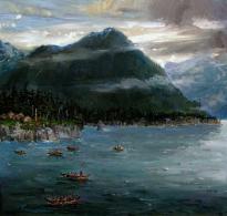
About one million lakes are localized on the flat plane, the water area of which is over 100 thousand km2. sq.

Rice. 2. Lake Chany.
Environmental problems of the West Siberian Plain
In areas where natural resources are extracted, in particular, the oil industry, due to pipeline breaks, inland waters and soils are polluted with oil products. In forestry, there are:
- excessive felling;
- waterlogging;
- increase in the number of silkworms;
- ignition.
The problem of fresh water shortage, as well as secondary soil salinization and destruction of soil structure, is extremely acute.
No less important is the problem associated with the extraction of mineral resources. Human activity negatively affects the ecosystem of many natural objects.

Rice. 3. Abandoned oil field.
In the northern regions, degradation of reindeer pastures due to overgrazing is noted. This factor affects the reduction of biological diversity. The issue of preserving hunting grounds and natural habitats of representatives of the animal world is also considered a problem.
Reserves and natural parks of national importance have been opened for the purpose of researching and protecting characteristic and rare natural landscapes.
Among the largest tundra reserves:
- Gydan Reserve,
- Verkhnetazovsky Reserve,
- Yugansky reserve.
A national park, Priishimskiye Bory, has been created in the taiga zone.
In addition, the natural parks of the tundra: Deer streams; taiga parks: Numto, Siberian Uvaly, Kondinsky lakes; forest-steppe park complex Bird's harbor.
What have we learned?
We found out the approximate age of the territory. We learned what human actions negatively affect the state of the local ecosystem. Find out the extent of the study area. We received information that the largest number of lakes is located on the territory of the plain. We got acquainted with the actions and attempts that are being made by society to preserve the nature of the plain and adjacent territories in its natural form and condition.
Topic quiz
Report Evaluation
Average rating: 4.6. Total ratings received: 321.